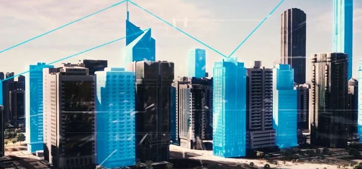
The project integrates the most advanced technology, such as aerial photography, LiDAR scanning and game engines…reports Asian Lite News
The Department of Municipalities and Transport (DMT) launched the Abu Dhabi Digital Twin project today at GITEX Technology Week 2022.
DMT unveiled details of the project at the Abu Dhabi government pavilion, which is home to 30 government departments showcasing several initiatives and programmes to improve services and life in the emirate.
Through the ‘Abu Dhabi Digital Twin’ project, the department will be able to use 3D augmented reality to facilitate and support decision-making processes, which is a qualitative leap forward in the emirate’s development of a digital and geographic information system.
The project integrates the most advanced technology, such as aerial photography, LiDAR scanning and game engines. It intends to promote the foundations and concept of smart cities and initiate and integrate augmented digital reality and metaverses for the emirate in accordance with the highest international standards.
First of its kind in Abu Dhabi, the project aims to showcase a comprehensive and accurate representation of the emirate, including the exterior shapes of the buildings. In addition to supporting the real estate market and highlighting landmarks across the emirate, the project provides details of interior structure to enable internal navigation of the buildings to support the speed of response in emergencies and support planning and decision-making processes.
Dr. Salem Al Kaabi, Director-General of Operational Affairs at DMT, said, “By creating a complete visualisation of the emirate using 3D modelling, the Abu Dhabi Digital Twin project assists in data analysis, facilitates decision-making, monitors the appearance of the cities in the emirate, and uses virtual reality to highlight the most notable locations for the public.”
The project will introduce a synchronous representation of the emirate, allowing users, such as planners, engineers, specialists, and public and private sectors, to explore the emirate’s development in 3D and evaluate vast amounts of data.
Additionally, the project provides decision-makers, experts, and specialists with accurate data and measurements for planning and operations across all critical sectors. It will offer spatial analysis tools that assist in analyzing the effects of various urban planning scenarios for making the appropriate planning decision in each of these scenarios.
A complete visual representation of building structures and other assets is developed by integrating the project’s outputs with multiple systems. It also ensures the continuity of updating data, including real estate systems regarding lease contracts, rental indicators, sale and purchase indicators, urban spaces and community facilities, building permits, asset management, addressing, and urban planning, commercial licenses, information about services, community facilities, and inspections.